


Kungsleden: Saltaluokta – Kvikkjokk Hiking Map: 1:50 000
ourprice £14.99
| Format | CB |
|---|---|
| Publisher | Calazo Forlag |
| Publication Date | 2025-05-01 |
| Pages | 2 |
| ISBN-13 | 9789189880139 |
In stock
Description
At Calazo, we have developed five maps at a scale of 1:50,000 with a unique level of detail that covers the entire Kungsleden route between Abisko in the north and Hemavan in the south. This map covers the Kungsleden route between Sáltoluokta mountain station and Kvikkjokk. If you are going to continue hiking south towards Jäkkvik and Adolfström, you can supplement it with the map Kungsleden: Kvikkjokk–Adolfström 1:50,000. This map includes Stora Sjöfallet, Sitojaure, Aktse, Skierffe, Årrenjarka and Pårtestugan. Here you will find an overview map showing our maps of the Kungsleden. This map is one of the maps we call the new generation mountain map. This means a level of detail that is not found in other maps of the same area. The terrain information is based on airborne laser scanning. In addition to completely new contour lines with an equidistance of 20 meters, watercourses and steep slopes are shown in a significantly better way than before. Trails are reproduced with greater accuracy, as are marshes, buildings, rocky ground and difficult-to-access vegetation. We have concluded that the best material for a map is Tyvek®. It is made of a synthetic fiber that makes the map completely insensitive to water and very tear-resistant. A Tyvek map does not tear in the folds or lose its color when you use it.
Additional information
| Weight | 0.052 kg |
|---|---|
| Dimensions | 1.1 × 20.9 × 12.8 cm |
| Publisher | Calazo Forlag |
| Imprint | Calazo Forlag |
| Format | CB |
| ISBN-13 | 9789189880139 |
| Publication Date | 2025-05-01 |
| Publication Year | 2025 |
| Pages | 2 |
| Country of Publication | GB |
| Language | English |
Related products
-

Stuart: A Life Backwards
ourprice £12.99 Add to cart -
Boy Erased: A Memoir of Identity, Faith and Family
ourprice £10.99 Add to cart -
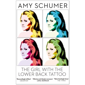
The Girl with the Lower Back Tattoo
ourprice £9.99 Add to cart -
Tattoo Sourcebook: Pick and Choose from Thousands of the Hottest Tattoo Designs
ourprice £30.00 Add to cart



Reviews
There are no reviews yet.